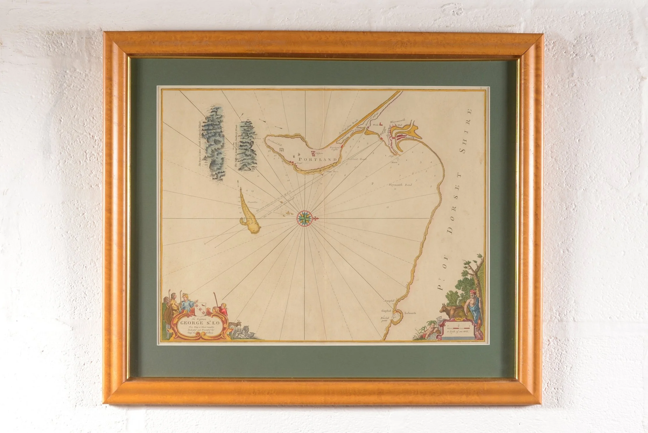
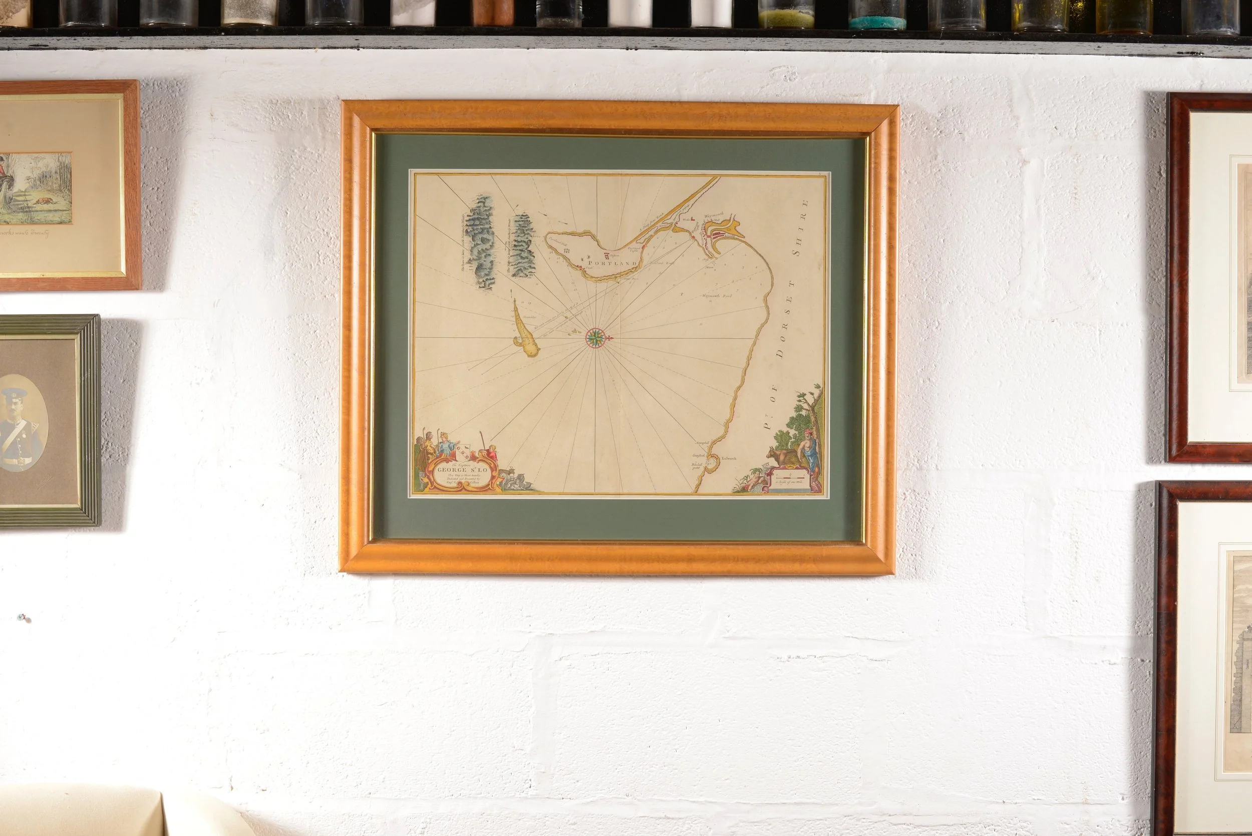
An Antique Sea Chart - Portland & Weymouth - By Capt. Greenvile Collins - c.1750
An original hand coloured copper plate engraving on laid paper, from Captain Greenvile Collins’s Great Britain's Coasting Pilot, first published in 1693. This was the first survey of the country's coast undertaken by an Englishman.
With dedicatory cartouche.
This chart probably dates to the mid 18th century.
Framed.
Condition:
Good condition.
Dimensions:
65 cm high × 77 cm wide x 2 cm deep.
Shipping not included. Please email me with your postcode for a shipping quote george@holtbyandco.uk
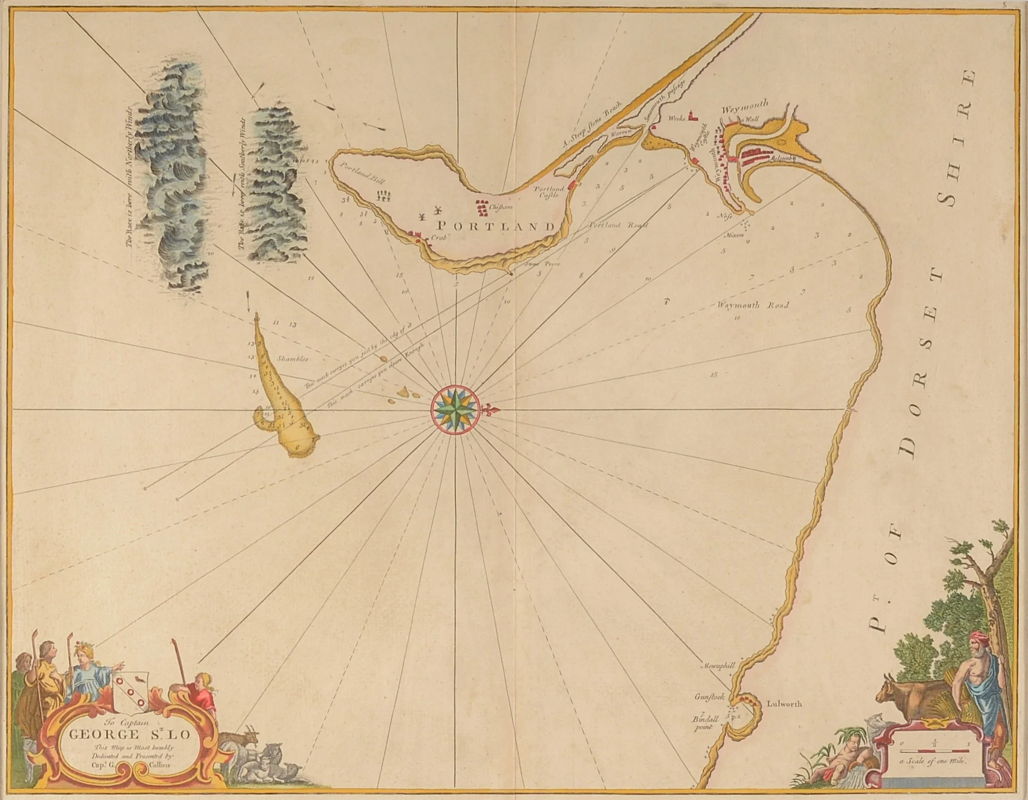